About the Mawson Trail
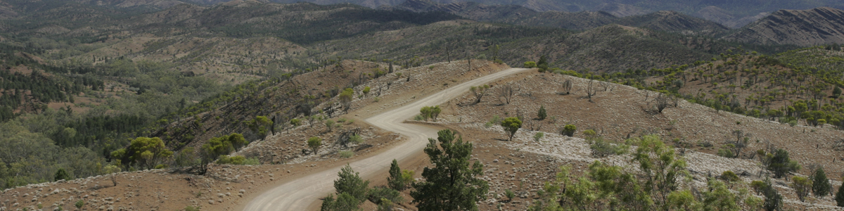
Starting just north of Adelaide and travelling to the Outback town of Blinman in the Flinders Ranges, the Mawson Trail is the ideal option for mountain bikers wanting to travel through South Australia’s remote rural areas.
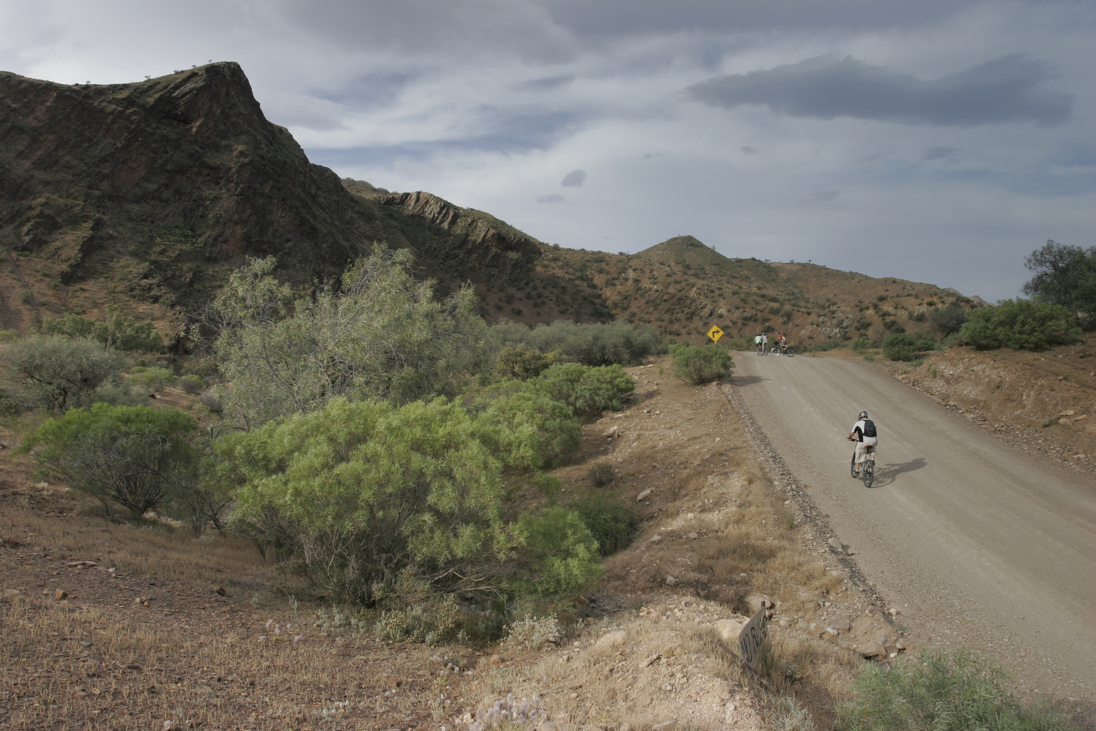
Close to nine hundred kilometres long, the trail includes little-used country roads, State forest and national park fire tracks, farm access tracks and unmade or unused road reserves and small sections of sealed road and single track trail. It avoids traffic and minimises use of sealed roads and leads cyclists into the remote areas of the Ranges.
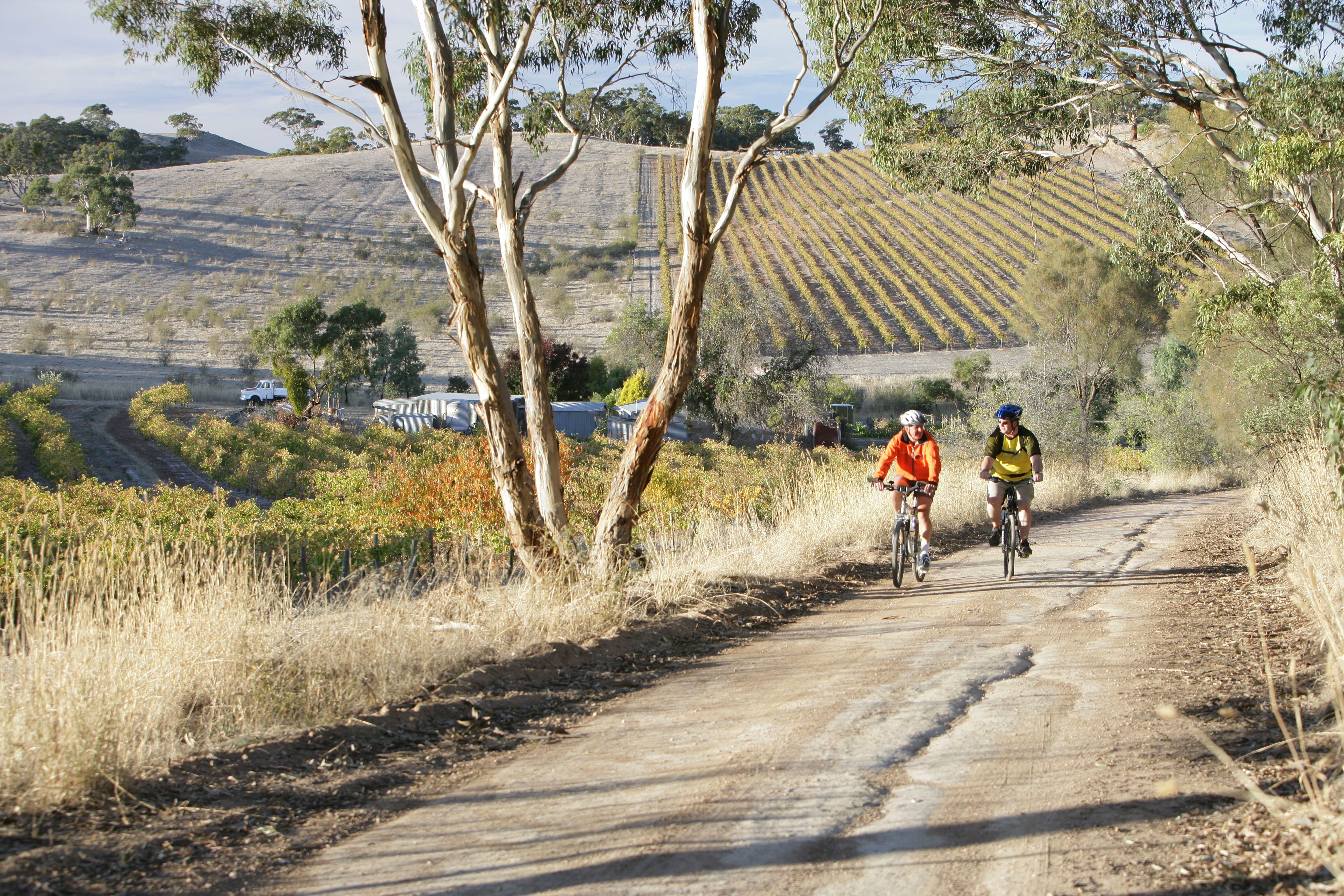
The trail takes riders through the Adelaide Hills, traversing forests, farmland and historic towns such as Lobethal and Birdwood. It passes through the world-famous Barossa wine region to the mid-north towns of Kapunda and Burra and, from here, winds pass the towns of Hallett and Spalding through the Bundaleer Forest and into the Flinders Ranges.
The Mawson Trail is designed for mountain bike or sturdy touring bike use – it is not suitable for road bikes. There are several steep uphill sections and heavy rain on unmade tracks can make cycling very slow or impossible. However, spectacular views, abundant wildlife, unique flora and extensive vistas always reward the hard physical work.
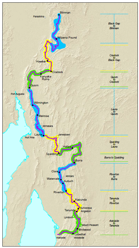
The 9 individual Mawson Trail maps are well annotated with history and sights along the way and each covering approximately100km of the track. They show how to get into and out of the towns and the typography and elevation for each day.
Mawson Trail Maps
The trail is divided into 9 map sections
- Map 1 Adelaide to Tanunda
- Map 2 Tanunda to Riverton
- Map 3 Riverton to Burra
- Map 4 Burra to Spalding
- Map 5 Spalding to Laura
- Map 6 Laura to Quorn
- Map 7 Quorn to Craddock
- Map 8 Cradock to Black Gap
- Map 9 Black Gap to Blinman
these are available as downloads from the Avenza Systems Inc. mapping app
The trail route can be viewed using the Location SA Viewer. Using the data search tool, search for Recreation Trails, hover over the trail routes to view.
Data.SA provides links to
- The Recreation Trails dataset
- A range of SA Government map viewers that may provide useful information for your planning.
Printed Mawson Trail maps at 1:750,000 scale are now available.
Bicycle SA, 11A Croydon Road, Keswick SA 5035.
Ph 08 8168 9999 Email: office@bikesa.asn.au
Mapland, Ground Floor, 81-95 Waymouth St, Adelaide

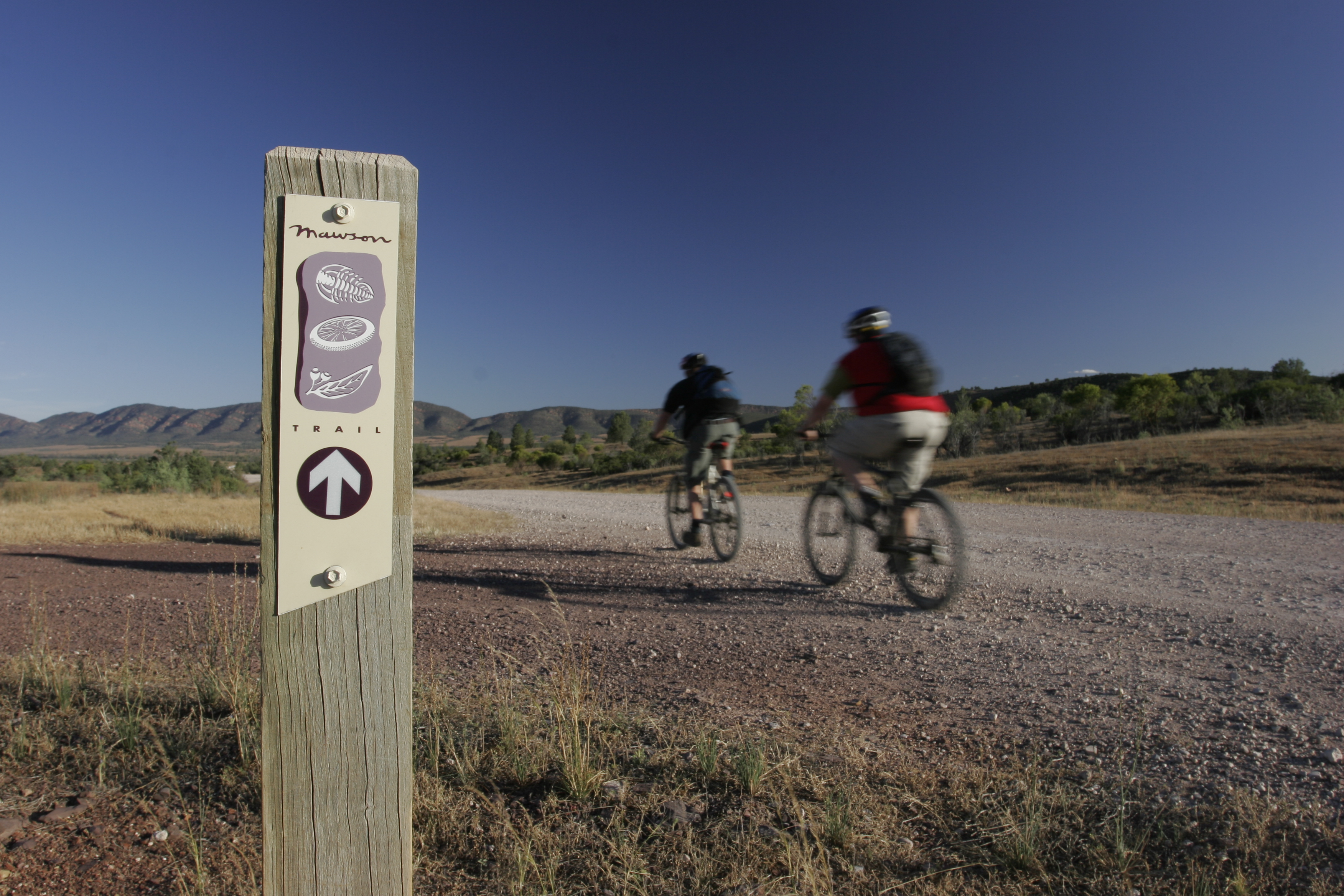
Trail markers and classifications
The Mawson Trail is marked with a beige and purple marker with a graphic of a trilobite fossi, bike wheel and gum leaf and a white directional arrow.
On the original sections of the trail these markers are attached to treated pine posts, fence posts or street signs. Over the last 5 years treated pine posts are being replaced with yellow ezy-drive posts and a trail marker sticker or new marker plates with a yellow background and red or white reflective rectangles which will be attached to fence posts or other existing infrastructure. Markers are placed at road and track junctions and when the trail changes direction.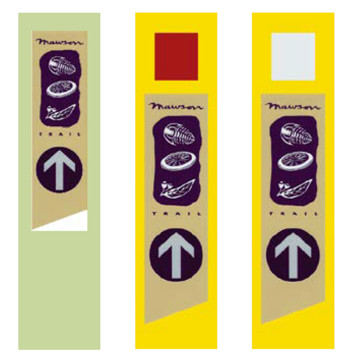
Markers are placed at 1-2 km intervals on straight sections of trail. Generally the trail is on low to moderate gradients. Some sections may exceed these criteria and steep sections of trail can be identified on the elevation scale graphic. Information under the heading Ride Notes includes detail on trail conditions
Under the Australian Mountain Bike Trail Guideline - Trails Difficulty Rating System the Mawson Trail would be classified as an Easy or Intermediate mountain bike trail.
Planning
The trail is open all year round, however the months of January to March can be fiercely hot and are best avoided. Check forecasts for the sections you are riding in your planning.
If you are planning to ride the Mawson Trail from Adelaide, you will need to organise transport from the northern end of the trail at Blinman. Or get transport to Blinman & ride back to Adelaide, which is probably the best option as will give you more flexibility & less time restrictions to your ride.
Check Transport operators websites for current services, costs, timetables, bike transport and bookings.
Beyond the Mount https://themount.au/
Beyond the Mount provides a shuttle service throughout the Flinders Ranges and beyond. Options available to meet your requirements.
Premier Stateliner www.premierstateliner.com.au
Premier Stateliner operate from the Adelaide Central Bus Station at 85 Franklin St. Runs buses per day from Adelaide to Port Augusta and back.
Angorichina Connection: David and Caroline Scicluna run the Angorichina Tourist Village in the heart of the Flinders Ranges. For information about the Tourist Village and pick up / drop off services with their range of vehicles www.angorichinavillage.com.au.
You will need an off-road bicycle to ride the Maw son Trail as it takes you along dirt roads and tracks that are not suited to a road bicycle. During heavy rain some dirt track s may be difficult to ride and in extreme conditions they may be impassable and you will need to take an alternative route. Some sections of the trail may be challenging depending on your fitness and experience.
It is advised that you plan your trip carefully
- Let someone know your ride plans
- Take spares and equipment with you in case of break down
- Check weather conditions before you leave and during the ride on www.bom.gov.au
- Carry sufficient water and food as reliable water supplies in country areas cannot be guaranteed
- Check mobile phone coverage with your provider as it is limited in many areas
- The trail is open all year round, but is best enjoyed between the months of April and November as the summer months can be fiercely hot.
- Carry first aid equipment and personal gear.
- Remove your waste
- Respect the land you traverse
National Parks and Forest Reserves are closed to the public on declared Total Fire Ban days and the public must not enter on these days.
To report a fire, call 000.
Cyclists must have adequate spare tyres and provisions and be prepared to ride off the bitumen and over rough and difficult terrain. It is highly recommended that you travel in a group of three or more, in case of accident or mechanical breakdown.
Correct and thorough bicycle preparation cannot be overemphasised, especially for those carrying panniers. Cyclists unfamiliar with any aspect of their bicycle’s mechanical function should seek expert advice prior to departure.
All cyclists should have provision for at enough water for the trip on their bicycles for use while riding, with more inside panniers for camping. All biddon cages should be checked for cracks and distortions, and mountings should be tight. Water requirements will vary according to the season but should never be underestimated. Water in creeks, waterholes and on the ground should never be drunk. Excessive heat will cause riders to consume a lot of water. In these conditions, a support vehicle should be considered.
Bike Riders:
- slow down when passing other trail users, or stop and allow them to pass you
- alert others when approaching from behind
Walkers:
- keep to the left w here possible
- keep dogs on leash (2 metres or less) and be mindful of other users passing
- be mindful of others approaching from behind
- to protect vegetation, avoid walking off trail
Runners:
- keep to the left w here appropriate
- be mindful of other users behind you
- alert other users when approaching from behind
Horse riders:
- horses have right of way over other trail users
- alert walkers when approaching from behind
There is a range of accommodation along the trail, check National Parks, Forestry SA, local towns and tourism websites for information:
Note that both National Parks and ForestrySA use online booking systems for campsites and accommodation and it is advised to pre book before arrival particularly during school holidays and on long weekends.
The Mawson Trail and the Heysen Trail traverse a few sections of shared trail and trail in the same tourism region. The Friends of the Heysen Trail page includes information on a range of accommodation from camping to motels and this resource can be used as a guide for accommodation.
Accommodation along the Heysen Trail provides information regarding Heysen Trail hut access, in particular bookings and access codes for the
Map 4: Old Mt Bryan East School and Hallett Railway Station Huts
Old Mt Bryan East School | The Friends of the Heysen Trail
Hallett | The Friends of the Heysen Trail
Map 6: Curnow’s Hut
Curnows Hut | The Friends of the Heysen Trail
and other campsites along the trails.
If you would like to report and problems or damage to the huts, trail infrastructure including water tanks and stiles, check the Friends of the Heysen Trail and Other Walking Trails website for trail maintenance information:
South Australia’s Visitor Information Centres (VICs) are an accredited body for tourism information. There are a number of Visitor Information Centres throughout South Australia providing quality service and reliable information. Look for the yellow Accredited ‘i’. Additionally, there are a number of non-accredited visitor information outlets available to assist you with local information. For general travel information and booking enquiries please contact the relevant VIC or visitor information outlet below. You can also connect to our free WiFi network.
Heading south to north the following information centres will provide further information:
- Adelaide Visitor Information Centre
- Adelaide Hills Information Centre
- Barossa Visitor Information Centre
- Light Country Visitor Information Centre
- Clare Valley Wine, Food and Tourism Centre
- Burra and Goyder Visitor Information Centre
- Southern Flinders Discovery Centre (Gladstone)
- Laura Information Centre
- Flinders Ranges Visitor Information Centre Quorn
- Hawker Visitor Information Centre
- Wilpena Pound Visitor Information Centre
These information centres may also be useful for trip planning:
- Peterborough Visitor Information Centre
- Port Augusta Visitor Information Centre
- Port Pirie Tourism and Arts Centre
Our Venues | Office for Recreation, Sport and Racing (orsr.sa.gov.au)
Recreation and Trails | Office for Recreation, Sport and Racing (orsr.sa.gov.au)
Bureau of Meteorology (bom.gov.au)
Visitor Information Centres | South Australian Tourism | South Au...
Plan a South Australian trip | SA Tourism | South Australia
Department for Environment and Water - Home
Bicycle SA - Home (bikesa.asn.au)
Outback Odyssey | Bicycle SA (bikesa.asn.au)
Melrose Mountain Bike Trails - Melrose MTB
The Friends of the Heysen Trail
Accommodation along the Heysen Trail
Walking SA | Find a Place to Walk or a Hiking Club | South Australia
Paddling Trails South Australia - Paddling Trails South Australia